
We’re adding Hexmaps to make our results easier to understand.
This can be a better way of understanding the election because it ensures that all constituencies are now equally visible. We’re still going to default to the geographic maps but you can easily toggle between the two.
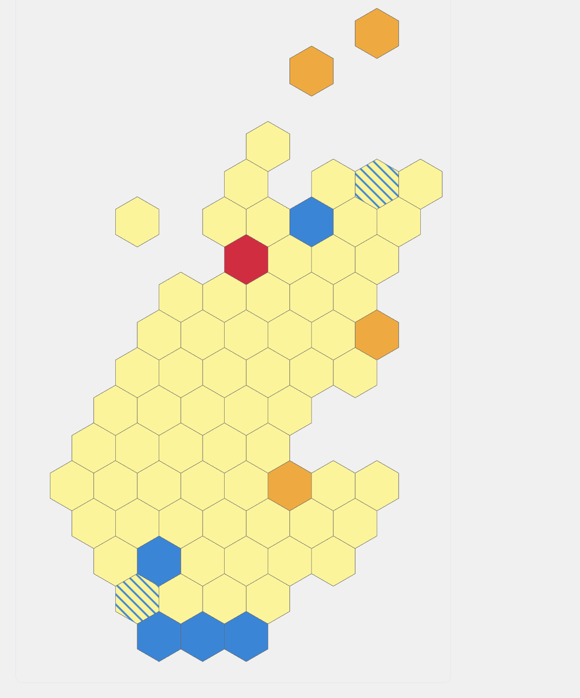
Scotland Constituency Hexmap
Each hexagon represents one constituency. Hover for details.
It’s especially useful in Scotland where all 73 Scottish parliamentary constituencies are laid out in a honeycomb pattern to better visualise results across the Central Belt. We’re adding hexmaps in Northern Ireland and Wales too, but there the differences in size between the smallest and largest areas aren’t as extreme as in Scotland. You can quickly find Belfast East and Caerdydd Penarth on geographic maps, unlike Glasgow Southside or Glasgow Central.
This is because of two factors. One is that Scotland uses First Past the Post for over half its seats, meaning it’s divided into a lot of smaller areas whereas 5 people are elected in each NI seat and 6 in Wales. But also it matters because Scotland is an unusually good example of ‘land doesn’t vote, people vote.’
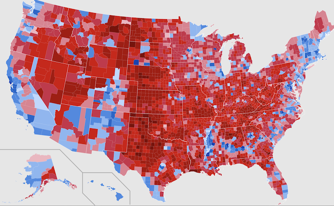
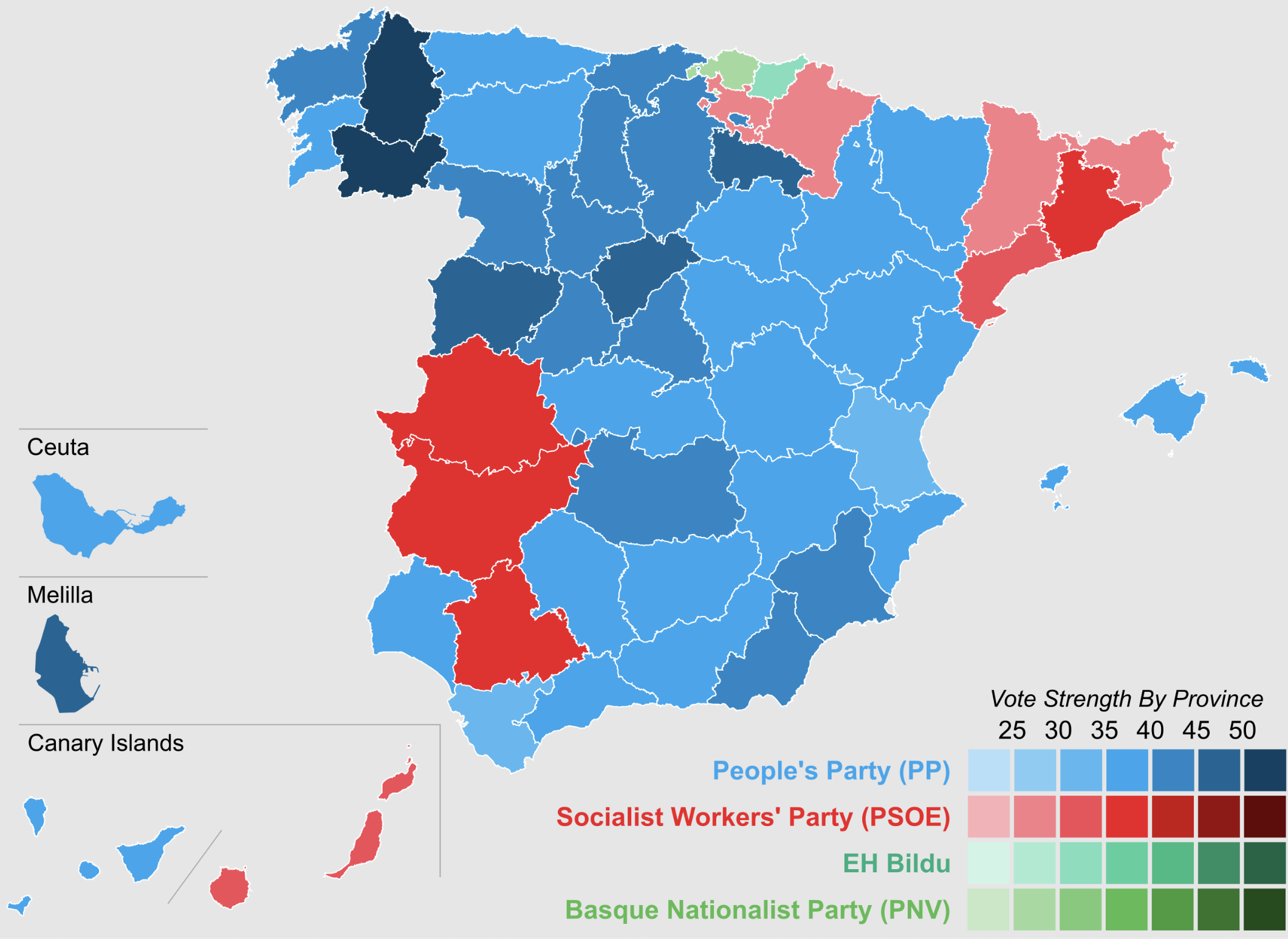
US elections are the most famous example of this and Spanish elections have the same issue, as does any other place with big cities and large rural areas. Scotland’s divide is especially extreme.
The Central Belt is a relatively thin strip across Scotland’s narrowest point which contains most of the population. It’s shaped a bit like a head and shoulders, with everyone living in the neck. This population distortion is driven by quirks of geography, like the presence of the Clyde and generally flatter terrain, but also the darker history of the Highland clearances.
It means that the constituencies within the central belt are really hard to see, but those in the South and North are easy to find. A hexmap equalises them - but your constituency might not be exactly where you’d expect.
Scotland Constituency Hexmap
Each hexagon represents one constituency. Hover for details.
We couldn’t possibly preserve all geographic realities when making this so we focused on broad strokes. Glasgow has so many constituencies that it bulges outwards to the point that it has to look coastal! It means that some neighbouring constituencies surrounding Glasgow have ended up quite far apart. Eg: Cunninghame North has ended up three hexes away from Inverclyde.
In Wales, there are fewer constituencies but some are geographically strange. Ceredigion Penfro is simultaneously the most western constituency yet is also extends further east than the two constituencies directly south of it. Brycheiniog Tawe Nedd is even worse. It touches the English border in Mid Wales, and then runs down half the length of the country to hit the coast in Swansea! The much lower population density in north, west and mid-Wales than in the South East is made clearer here.
I’ve settled on this:
Constituency Hexmap
Each hexagon represents one constituency. Hover for details.
NI’s 18 constituencies are laid out as follows:
Westminster Constituency Hexmap
Each hexagon represents one Westminster constituency. Hover for details.
I’ve settled on this version because every other way of organising the various constituencies in Co. Down looked worse. Preserving Lough Neagh is a stylistic choice but it does help to give a better sense of how much more heavily populated the east is than the west.